Section 10 Overview
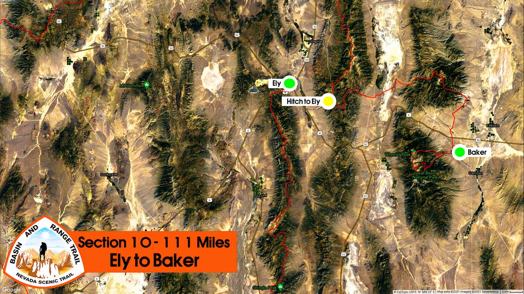
Ely to Baker - 111 miles
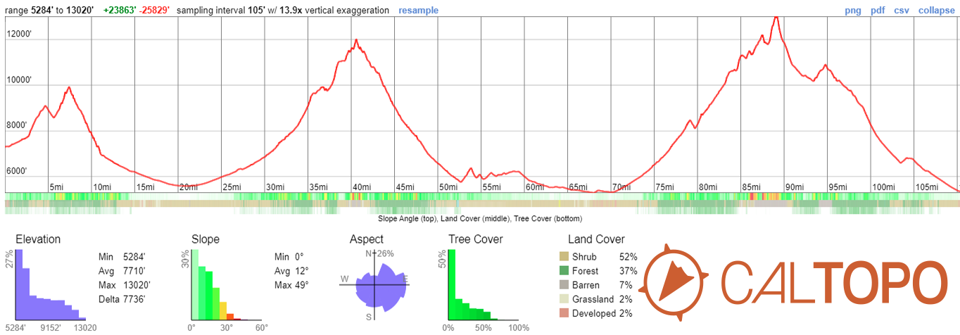
From Cave Lake State Park, continue east across the Schell Creek Range over to the Snake Range and the Mt Moriah Wilderness. Multiple routes exist here. Some bushwhacking involved, but the canyons are impressive, with some very interesting rock formations. Water is not an issue in the canyons. "The Table" is a flat plateau at 11,000ft that makes an excellent camp, with views of Mt. Moriah. The Summit of Mt. Moriah is the first 12,000ft peak along the BRT, and provides massive views. Hendry's Creek is the preferred route down off Mt Moriah. Excellent trail, flowing water, and one of the most impressive canyons of the entire BRT. Set your own course for Great Basin National Park, home to the 2nd tallest peak in Nevada, Wheeler Peak at 13,064ft. Take Baker Creek up to the ridgeline (or choose a canyon farther south to extend the ridgewalk) and walk the crest to Wheeler Peak. This off-trail traverse is the culmination of your BRT journey, and the symbolic end is Wheeler Peak. It's all downhill from here, 18 miles to Baker, endpoint of the BRT. Woo-hoo, you've done it!
Basin and Range Trail Section 10 - Route Description
Leaving Cave Lake State Park, make your way east across the Schell Creek Range and into Spring Valley. Aim for Negro Creek, which will take you up into Deerhead Canyon, and into the Mt Moriah Wilderness. While not an official alternate route, consider taking an extra day to explore Smith Canyon to the north. Either way, you'll reach an area called "The Table", a huge flat plateau at 11,000ft. Excellent camping can be found here, along with abundant wildlife and stunning views of Mt Moriah. Here, ancient stands of Bristlecone Pines grow big and tall. These trees can live to be over 4800 years old!
After bagging the 12,073ft summit of Mt Moriah, head down into the incredible Hendry's Creek. Water is not an issue here, you'll have a great trail to follow and plenty of shade in this lush canyon. The lower you hike, the more impressive this canyon becomes. Eventually, you'll find yourself looking straight up at the sky to keep track of the top of the canyon walls. This is another place that will leave you wondering how it's possible that it flies under the radar. But, as you know by now, this is par for the course in Nevada.
The lower reaches of Hendry's Creek present a dramatic change in scenery as the canyon opens up. Here, there trees thin and disappear, the green vegetation is gone and it begins to give way to desert. Work your way around the south side of Mt Moriah through an area called "The Cove". Here, there is a "gunsight" style pass, with Wheeler Peak right in the middle, your next destination. A fitting way to approach your final mountain adventure on the Basin and Range Trail.
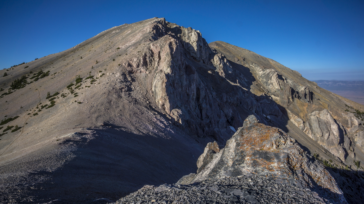
Walk through the town of Baker on your way into Great Basin National Park, and up into Baker Creek. Take this up to the ridgeline, perhaps camping at Baker Lake for the night. Once on the crest, you realize there is little to help you on your traverse to Wheeler Peak. There is climbers trail or use trail, no cairns, nothing but miles and miles of boulders. It's a difficult walk, but an incredible way to end your BRT journey. Bag Baker Peak, then traverse towards Wheeler Peak. Looking back at Baker Peak, you will gaze up at one of the tallest sheer rock walls in the entire Great Basin.
Climb your way to the summit of Wheeler Peak, the second tallest in Nevada at 13,064ft. The town of Baker is still a half day's walk away, but this is the symbolic end point of the BRT. From here, you will have the perfect place to reflect upon your Nevada thru hike adventure. Walk the ridgeline down to Stella Lake, and perhaps over to Rock Glacier in the cirque below Wheeler Peak on your way down out of the mountains. Don't forget to check out Lehman Caves on your way into Baker, the end of the Basin and Range Trail.


