Basin and Range Trail Planning Resources
The goal of this website is to spread awareness of the Basin and Range Trail and provide the necessary resources for future hikers to enjoy this trek-of-a-lifetime. However, the Basin and Range Trail is simply not suited for every hiker, and it is critical that you determine whether or not this trail is right for you before setting foot here.
Disclaimer: The Basin and Range Trail is a route, not a beaten path or trail. It is extremely important that potential hikers understand the differences between the Basin and Range Trail and other long distance hiking routes, specifically those within the National Scenic Trail System such as the AT, PCT and CDT. This route is not recognized by any the National Forest service, BLM or any other agency. There are no trail or route markers along the way, there are no trail angels, the locals haven't heard of the BRT and aren't used to seeing hikers of any kind. While many experienced long distance hikers are searching for this type of experience, this is NOT the place for your first long distance hike, or the beginning backpacker. Setting foot on the Basin and Range Trail requires a skillset that includes cross-country hiking and navigation, bushwhacking experience, previous long distance hiking experience and water management skills. In short, it's up to YOU to make sure you are not only physically and mentally prepared for this route, but that you also have more advanced backpacking skills to keep yourself out of trouble. There are no other hikers, no cell phone service and in many cases, no other people that even visit the general area, ever.
*Note: The best way to get a feel for what the Basin and Range Trail is like is to watch the detailed Basin and Range Trail video series. Pictures and descriptions alone are not enough. Sections 2, 7 and 8 have some pretty intense bushwhacking, and it's in your best interest to educate yourself on the reality of this route before committing to it.
Basin And Range Trail Maps
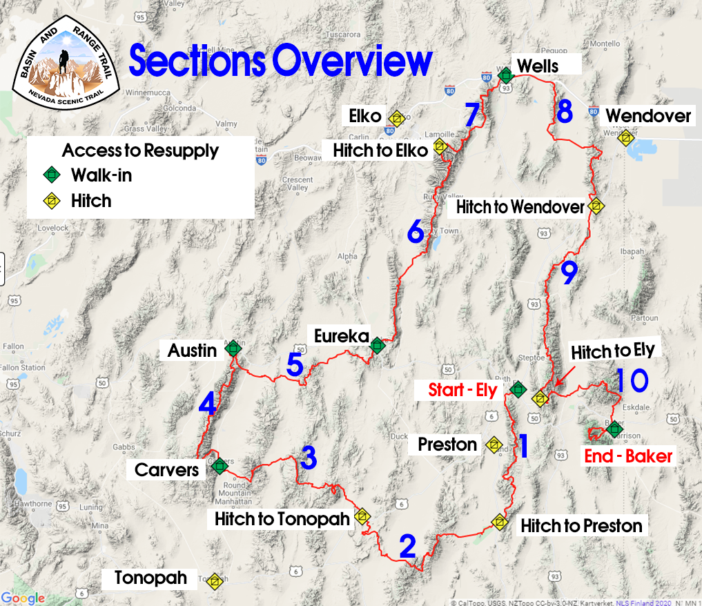
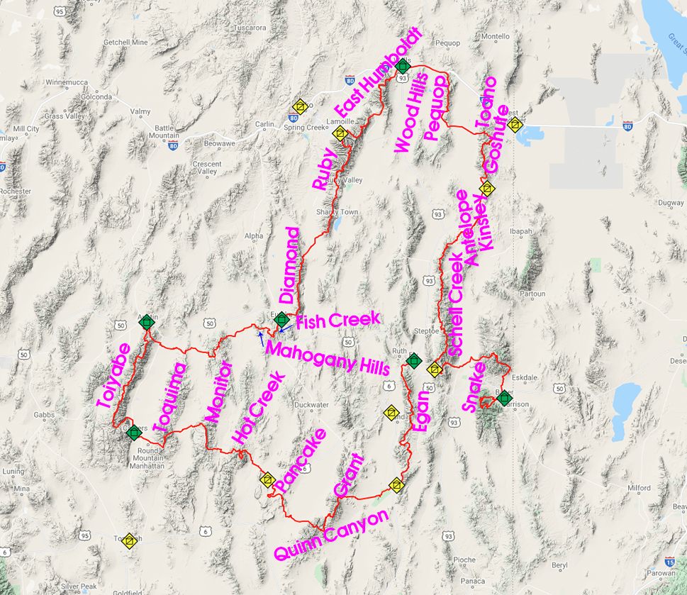
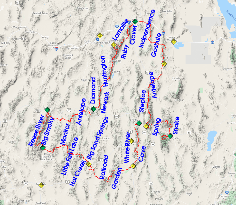
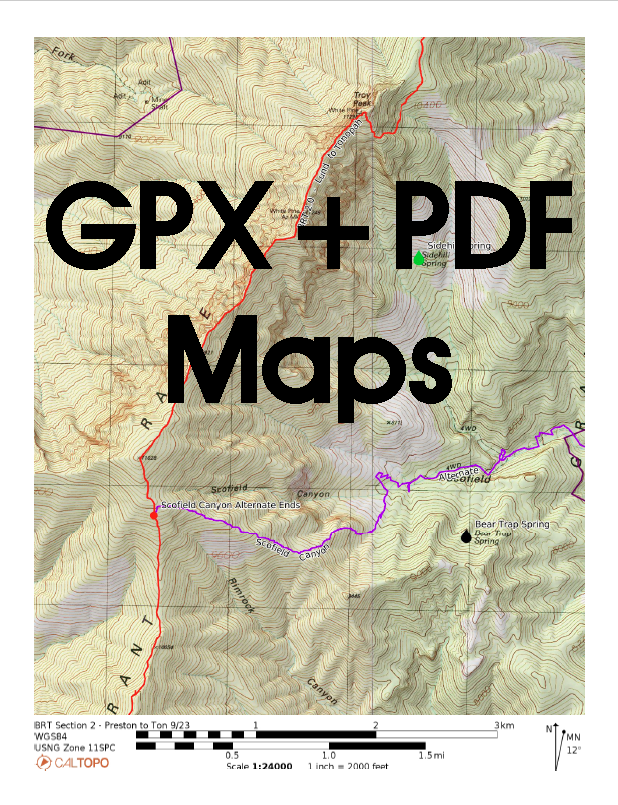
The Basin and Range Trail Sections Overview map highlights the 10 sections of the route and its resupply points. Below, maps of the Basins and Ranges provide quick and easy geographical reference to familiarize yourself with the route. Additionally, the water map provides a fast way to size up the availability of water along the route, allowing you to see which sections are dry and which are rather wet. Detailed maps and a water chart with over 190 water sources along the route are available as premium planning resources in the Shop.
Logistical Overview
The main logistics a hiker must face for a thru hike of the Basin and Range Trail is when and where to start. The information provided in the Official Basin and Range Guidebook presents a route that starts in Ely, hiking a quasi-loop clockwise, returning to Ely at the end of section 9 and setting out for one final section, beyond what would be considered the end of a loop. This is considered the "standard route", but of course, BRT hikers are free to modify this route to fit their needs and goals.
Days on Trail
The miles here are MUCH slower than a typical thru hike, because of the frequent bushwhacking and cross-country hiking across rough terrain. The hike will take much longer if you stick with the bushwhacking, not bailing out and taking alternates. The route variables could mean a total mileage of 900-1100+, which also has a big effect on your time to complete the route. Not counting zero days, figure 45-55 days for a "typical" thru hike of about 1000 miles.
Seasonality of a Basin and Range Trail Thru Hike
The BRT could be hiked in the spring, summer and fall. However, most hikers will prefer this hike in mid-May to mid-July timeframe. The southern portion of the route is the warmest/lowest elevation, and that is why it is hiked first. In many years (snow has been low in recent years) the Toiyabes hold significant snow into June. The Rubies, Schell Creek Range and the Snake Range can all hold snow into July. In the southern portion, the Egans and Grant ranges both spend time over 10k feet, and reach 11k feet, so these can hold snow later into the season as well. Those who don't mind the snow, or don't mind bailing and walking around if high snow is encountered, can start earlier in the season, say, April. Those looking for a snow-free hike should wait until around 1st or second week of May at least, potentially later depending on the year. Start too late and the heat is an issue from mid July on, and water sources start to dry up. The ideal start date is based off the snowpack for the current year. Your goal is to have snow melt to draw water from while hiking the crest of the Toiyabes and Diamonds, in sections 4 and 6.
Weather & Climate
Those unfamiliar with Nevada often think of the state as a giant extension of Las Vegas, one big hot desert. Many are surprised to realize that the rest of the state varies as much as it does. Las Vegas sits in a valley at around 1800’ elevation, while the lowest point along the BRT is 4800’. Only once does it dip below 5000’. Most basins are around 5500’, with some as high as 6500’. Those are the LOW points along the route. Sure, it can be hot on the BRT, but nowhere near as hot as Las Vegas, due to higher elevations. Central and northern Nevada is a different environment. The rest of the state does not see the 115 degree temps that Las Vegas does.
See the Koppen climate classification map of Nevada below, with the BRT route overlaid:

You can see in southern Nevada, the red, which indicates “hot desert”. This is the desert most people think of when they think of deserts. In the southern portion of the route, along sections 2 and 3, you will encounter “cold desert” environments, but the rest of the low valleys along the route are mostly “cold semi-arid”. The mountain ranges are mostly “warm-summer Mediterranean continental” and to a lesser extent, “warm-summer Mediterranean”.
Expect bluebird skies nearly every day in June with mild temps. The low valleys aren't too hot this time of year, and can actually be quite cold still on occasion throughout June. There is still the possibility of snow storms in June, expect a dusting or two at high elevations. The temps heat up around the beginning or July, and getting uncomfortable by mid July. Afternoon thunderstorms were sparse during my 2020 thru hike, only occurring within one week window in late July. July and August will routinely see temps of the 90s and during a heat wave, the low 100s in the valleys along the BRT. It’s almost always windy in Nevada, and the winds are often high. The good news is that the winds generally die down at night. There are very few overcast days, so be prepared to be exposed to direct sunlight for the majority of your hike.
Premium Planning Resources
The Basin and Range Trail is a custom creation, the result of several hundred hours of planning and a thousand more to document it all. While you will feel a great deal of pride creating your own route from scratch, or a bare minimum of resources, many hikers simply do not have the time or interest in such detailed planning. You can shortcut the lengthy planning process, saving yourself hundreds of hours of research and planning, by purchasing these premium planning resources for your Basin and Range Trail thru hike.
While the Complete Basin and Range Trail Guidebook & Planning Kit provides the most comprehensive planning resource available for the BRT, you can also purchase each planning resource individually if desired on the Shop page.
*Considering a Basin and Range Trail thru-hike? For a limited time, receive the complete BRT planning kit, a $55 value, for FREE. Simply join the Basin and Range Trail facebook group, send me a direct message, and I'll provide a download link to all the resources below. Hope to see you on the Basin and Range Trail soon!
*Gear list below contains affiliate links. I will earn a small commission, at no cost to you, if you choose to purchase certain items on the list, and will help support this website.
Additional Basin and Range Trail Thru-Hike Planning Resources
Seeking Lost's Basin and Range Trail Thru-Hike Vlog Series - 10 episodes, 11 hour runtime. This detailed documentary series is the best way to get a feel for what the Basin and Range Trail is like.
Pioneering Nevada's Basin and Range Trail - Documentary condensing a Basin and Range Trail thru-hike into a 60-minute film.
Seeking Lost's Basin and Range Trail Journal & Photos


