The Basin and Range Trail PDF map set uses USGS maps at a 1:24k scale, and uses a shaded overlay to enhance terrain features on the map. The map set includes all navigational waypoint markers, indicating when the surface type changes, from 4×4 road to cross country hiking, from cross country hiking to a single track trail, etc. Water sources also also displayed on the PDF map set, and they are color coded for a quick and easy way to determine how reliable the next water source is. All waypoints and tracks are labeled on the map. Boundaries for National Forest lands, Wilderness and Wilderness Study Areas are also displayed on the map. These maps are ready for you to print out, or simply add them to your phone to use in the field for navigation.
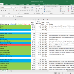
Also included is the Waypoint Excel Spreadsheet for a quick reference to all the waypoints along the route.
NOTE: Currently, there are some accuracy issues with the mile markers for the waypoints in the waypoint excel sheet. The mileage in between points should be accurate, but the mile marker for that waypoint (the Mile # column) has some accuracy issues due to the limitations of the service used to using to create these sheets. In the meantime, these sheets are still being offered as part of the package because of the value they still provide; an easy to view list of the waypoints, elevation, coordinates etc.


Reviews
There are no reviews yet.